Our driver in Dominica verbalized the arduous lesson our calves and quads have been schooled in repeatedly over the last year of Caribbean hiking: “What comes down must go up.” Don’t be fooled: Any relief you think you’re getting in a decline is foiled by twice the burn on the next incline, making up for the lost elevation. And if it’s a round trip along the same trail, the decline will be climbed up in reverse on the way back, after all the adrenaline from summiting has long since faded. In the Caribbean islands, you’re going to go up, so you might as well go straight up.

It’s About the Destination, Not the Journey
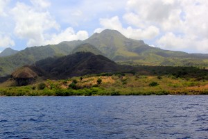
My favorite hikes in the eastern Caribbean are the ones where we’re socked in by dense rainforest or cloud forest – thick green moss carpeting the rocks and trees, lush green trees creating walls around us and ceilings over us, heavy white fog filling every free crevice and dripping down our faces. We’re weaving up a path worn into the rich, burnt-orange volcanic mud that is deeper than our knees and no wider than our hips. We’re searching for handholds in the roots and rocks, or hand-over-hand on ropes tied to trees. If there are leaves or rocks underfoot, they’re slippery. If there are plants or trees at hand’s reach, they’re prickly. There is nothing to do but keep planting foot after foot, keep firing quad muscle after quad muscle, keep breathing in through your nose and out through your mouth, all the way up the mountain. There are no vistas along the way tempting you off the trail to snap a selfie. There are few other hikers passing to distract you in sedentary conversation. There is a hill to climb, one step at a time.
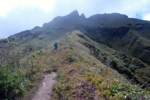
A hill to climb is rather like a sea to sail on a long passage, one nautical mile at a time. Both afford complete isolation, slogging along slowly and blindly toward a coveted destination. You are surrounded by endless trees on the mountain and endless waves in the sea as far as the eye can see, and further yet you realize the further you go. You repeat to yourself “On, On!” hiking and “Sail ho!” sailing, knowing how sweet it will finally be to utter “Summit ho!” and “Land ho!”
You shout the proclamations of a goal completed, because it really is about the destination. The journey is just the best way to get there, ideally using nothing but the wind, the sun and your body.
Up, Up and Away
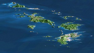
In the Caribbean islands, as soon as the flats of the Bahamas recede, mountains soar from the sea and prod the clouds. Approaching each island, I look out over the horizon to pick out which peaks we will hike – usually the tallest, sometimes the greenest and always the steep volcanoes.
 The first to come is the tallest: Pico Duarte (Dominican Republic, 3098m/10,164ft); it’s on our to-do-list for May 2016.
Working down the chain and up the higher peaks, there is:
- Cerro de Punta (Puerto Rico, 1338m/4390ft);
- Signal Hill (St Thomas, 435m/1427ft, on the to-do-list for March 2016);
- Paradise Peak (St Martin, 424m/1391ft);
- Morne du Vitet (St Barth, 286m/938ft);
- Mount Liamuiga (St Kitts, 1156m/3792ft);
- Nevis Peak (Nevis, 985m/3232ft, climbed May 2015);
- Quill (Statia, 601m/1972ft, climbed May 2015);
- Mt Scenery (Saba, 887m/2910ft, climbed February 2016);
- Boggy Peak (Antigua, 402m/1319ft);
- Chances Peak (Montserrat, 915m/3002ft, off limits due to recent volcanic activity);
- Soufriere (Guadeloupe, 1467m/4813ft, climbed January 2016);
- Morne Diablotins (Dominica, 1397m/4583ft);
- Pelee (Martinique, 1397m/4583ft, climbed May 2015);
- Mt Gimie (St Lucia, 950m/3117ft);
- Soufriere (St Vincent, 1234m/4049ft); and
- Mt St Catherine (Grenada, 840m/2756ft).
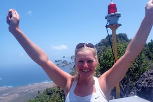
That’s a lot of altitude for a girl raised in the cornfields of the Midwest and groomed in the grid of Manhattan. As my running buddies have learned, I do not do hills. As my law colleagues know, I love to set goals and complete them. So it’s a very slow, steady, stubborn trudge up these Caribbean mountains, and a quick trot down. There is nothing more painful and laborious to me than the hike down – the goal has been completed, and I’d like to be done with the whole affair – so I go down the mountain as fast as the terrain and my legs allow. Jason always warns new hiking and running partners that come to retrieve me from the boat, “She’ll never keep up with you, but she’ll always beat you.”
As a consequence, we hike a lot of less-mountainous mountains too – each special for its own reasons. Here is our list of Top Five Caribbean Island Hikes, with a few honorable mentions.
Top Five Caribbean Island Hikes
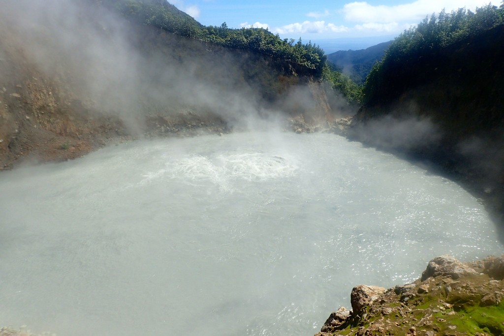
- Boiling Lake, Dominica (800m/2625ft of elevation, over 70m/230ft wide) – An eight-mile hike that takes the better part of eight hours to complete – lunch break, swim break and mud facial break included.
The hike up (and down) Morne Nicholls (975m/3200ft) will solidify your calves and quads; the walk across the Valley of Desolation, dodging boiling springs and steam spouts, will solidify your soul; and a single glimpse at the massive, explosive boiling lake – big boiling bubbles bursting out of the gray-blue sulfuric viscous water, and clouds of impenetrable steam wafting over the viewing plateau – will bring you to your knees. You are looking down into the heart of the earth, and it is a hot and steamy frightening mess. I could watch it boil all day long.
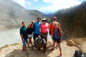
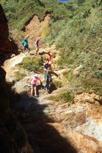
We climbed to Boiling Lake on a dry, sunny day in mid January 2016, accompanied by Henry and Catherine on Mowzer and Lann and Stan on Barefoot Life, and guided by the very fun and knowledgeable Sea Cat. I normally prefer to hike without a guide, but Sea Cat was a joy to hike with, and I wouldn’t have wanted to cross the Valley of Desolation without his knowledge of which springs are boiling hot and need to be stepped over. Boiling Lake is part of the Morne Trois Piton National Park, a UNESCO World Heritage Site, which charges a user fee (US$5 per site, US$12 per week).
8.0 miles, 8.0 hours, 871m/2856ft ascended
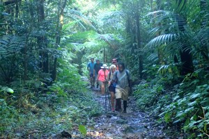

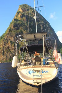
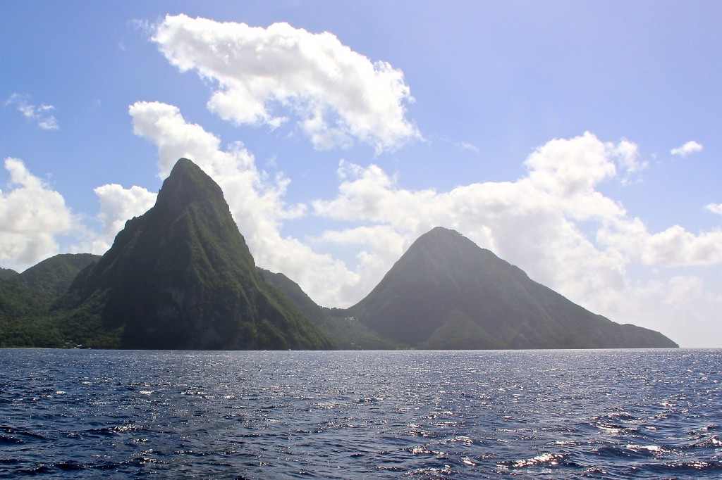
- Gros Piton, St Lucia (800m/26000ft) – The Pitons – two eroded lava domes – rise right out of the Caribbean Sea on St Lucia’s southwest coast, cradling a palm-tree lined, white-sand beach in between them.
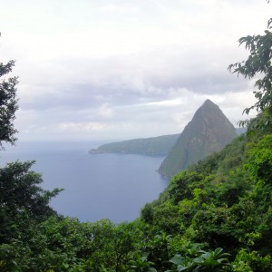
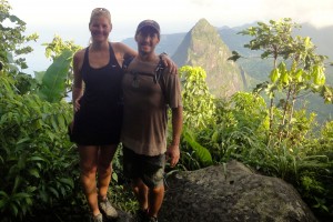
The climb up Gros Piton is one of the easier hikes we’ve done, thanks to our guide who agreed to meet us at 6am to beat the sun and the diligent caretakers that tend to the trail. When I look at photographs of the Pitons – of the peaks from the water, of Blue Moon anchored in the bay between them, and of us in front of Petit Piton from the top of Gros Piton – it is still unbelievable to me that we climbed to its peak. It’s like the feeling I had after climbing Mt Fuji in 2010 – an iconic mountain that I’m proud to have conquered, but a hike I wouldn’t need to repeat.
We hiked Gros Piton in early December 2015, guided by Jeffrey. The trail is well blazed and the stairs and banisters are meticulously maintained. The park requires you take a guide and charges a permit fee (US$30 per person plus guide fee). Petit Piton is a more rigorous hike with ropes; it remains on the to-do-someday list.
4.0 miles, 3.25 hours, 592m/1941ft ascended.
-
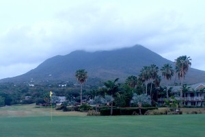
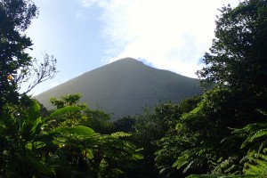
#3: Nevis Peak Nevis Peak, Nevis (985m/3232ft) – Stratovolcanoes like Nevis Peak beckon me to come climb – a cosmic-like draw I can’t quite explain, especially given my aversion to hills. They are usually isolated from other mountains and are nearly perfectly symmetrical cones, offering a straight ascent and an unobstructed view (if not shrouded in clouds). Nevis Peak is my favorite stratovolcano. It’s a big mountain on a small island; sailing by, it is unmistakable; climbing it is a joy. The trail is worn deep into slippery volcanic mud with a few large boulders strewn along the way. Steps are often waist high and ankle wide. Ropes along much of the trail make it possible to ascend and descend the steep incline without crawling on your belly or sliding on your behind; the way down is really a rappel down through the cloud forest.
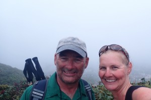
I hiked Nevis with Steve on Slow Flight in mid May 2015. We did not use a guide or have a map, a testament to how well blazed the trail is. It had rained recently, but not that day, so the trail was slippery but passable. The summit was shroud in clouds, but we’d done it for the hike, not the view. My Garmin didn’t record the hike, but I estimate it took us about 4.0 hours to ascend and descend approximately 650m.
-
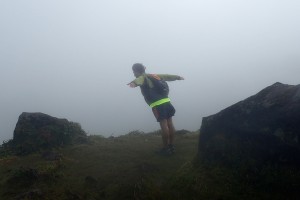
Cliff Diving at Soufriere GDP Soufriere, Guadeloupe (1467m/4813ft) – Guadeloupe is a big island – the biggest in the French Antilles; Soufriere sits all the way in its southwest corner as though it is trying to topple the entire northeast-heavy island over. It was last active in 1977; 38 years is a very short time in geological terms (or so I keep telling my 37-year-old self). The crater still evidences a hot, rumbling lava core, and potential volcanic activity is closely monitored. The hike itself is not difficult; the trail begins only after a long car ride up the mountain; much of the initial incline is short, smooth stairs and the middle portion is flat paved and dirt roads. The upper portion is a tight, steep path carved into the rock, made more difficult by the whipping wind and thick fog.
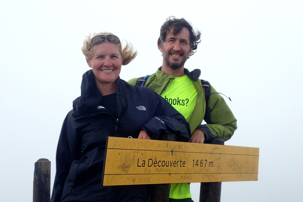
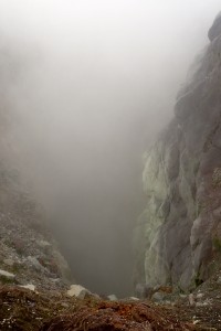
We climbed Soufriere in late January 2016 with Henry and Catherine on Mowzer. It was a calm, warm, sunny day, and still the summit and crater were shroud in clouds and its upper half was wind swept. I wouldn’t have wanted it any other way; the hanging clouds mingled with the wafting steam coming up from the crater, transporting us into an eerie other-worldly place. Jason faked a voice of the mountain – a low, growly yearning to come out and play – and for a second I looked around convinced the mountain was warning us of an imminent eruption.
4.4 miles, 3.5 hours, approximately 670m/2200ft ascended.
-

#5: Tree Pose along the Canal Canal de Beauregard, Martinique – Along the Canal de Beauregard on Martinique, hikers teeter along a concrete wall barely wider than a foot in some places, over drop-offs several hundreds of feet. From atop the irrigation canal, you look down over farmland, hillsides and forests – a peak at what the now-very-manicured Martinique might have looked like before St Pierre became the Paris of the Caribbean in the late 1800s and early 1900s. The stonework is impressive, the moss mystic and the views breathtaking. For a brief moment in time, we were transported to the mid-1700s, a time when slaves to build such a spectacle were plentiful and plantations in desperate need of the water it could provide were ubiquitous.
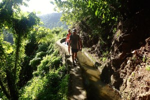
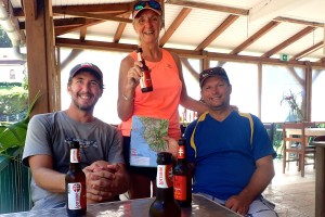
We hiked the Canal in early January with Henry and Catherine on Mowzer. The St Pierre anchorage isn’t great, and we’d already explored the town on our way down last May, so I wasn’t convinced the Canal hike was worth a stop; luckily our friends convinced us otherwise. We walked up from the anchorage in St Pierre, and on the way back (because Henry really loves hills) we hiked up to the very quaint town of Fonds-St Denis and over the very steep hill of Morne de Cadets (523m/1716ft). The Canal itself was an easy hike, and we were aided by a Lorraine (a delicious Martinique beer) stop in Fonds-St Denis, but it is the second time in my life I thought a Lorraine at the end of a hike would save me from certain death from dehydration.
Canal: approximately 2.5 miles, 1.5 hours, 20m/66ft ascended. Round trip to St Pierre: approximately 8.0 miles, 4.0 hours, 500m/1640ft ascended.
Top Caribbean Island Hikes – Honorable Mentions:
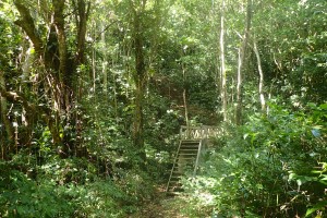 Waitukubuli Trail, Dominica – Within a few hundred meters off the road on to the trail you are engrossed by rainforest; you hike for hours without seeing or hearing another human being; and then you pop out at the end of the segment on another major road where you can catch a bus back home. The 114-mile trail, split into 14 segments, winds through all the untouched wild of Dominica, and it’s very untouched, and very wild.
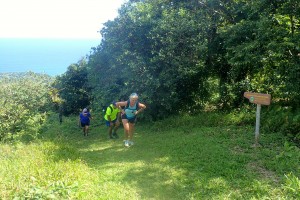
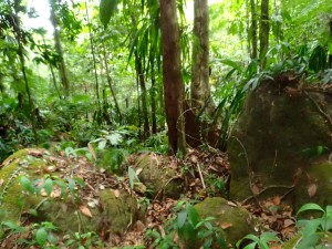
We had hoped to spend a couple of weeks hiking and camping on the trail, but only got a handful of days on random segments in the north. The rest of the trail is on our to-do-someday-list.
A day pass is US$12, and a two-week pass is US$40.
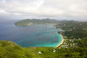 Peggy’s Rock, Bequia – Admiralty Bay cuts deep into the island of Bequia, spotting the coastline with rich reefs and sandy beaches. Other than the uncared-for mooring balls and the sand-covered rock bottom, it is a very calm and safe harbor. The climb up Peggy’s Rock on the southwest shore of the bay puts it all in perspective: Bequia is a much bigger island than the bay would indicate, stretching far northwest; and the bay is a much more dangerous place than the placid waters would seem – riddled with shoals and reefs just meters from the wind and waves that whip down the northwestern coast of the island. You might linger for a long while on the rocks at the top taking it all in, before scrambling down the rocky ravines on the bay side of the mountain. We kept thinking we’d lost the trail given the difficulty of the scramble, before realizing there was no blazed trail to be following in the first place. Fun!
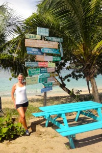
We hiked Peggy’s Rock in early December 2015. We met a couple of Brits at the top, who invited us to beers at Keegans at the bottom. I love hikes where there is a good bar at the base waiting for you.
6.0 miles round trip from Port Elizabeth, 2.5 hours, 717m/2353ft ascended
-
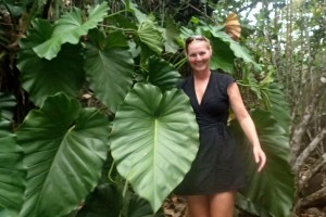
Deshaies River, Guadeloupe Deshaies River, Guadeloupe – It’s a scramble up truck-sized boulders along a trickling creek. If it has rained recently (as it usually has), you’re on your hands and knees trying to out-maneuver the slick moss between you and the rocks that wants very much to toss you into the river. After about an hour of scrambling, you reach the coveted waterfall, but its downpour and pool are another big rock away. You wedge your body between a rock and a hard place, slithering through the narrow cut and over the boulder to the promise land – an unending source of clean fresh water. There is a road back into town that winds by a monastery and farmland; the decline is surprisingly steep, telling of just how much elevation you went up along the river.
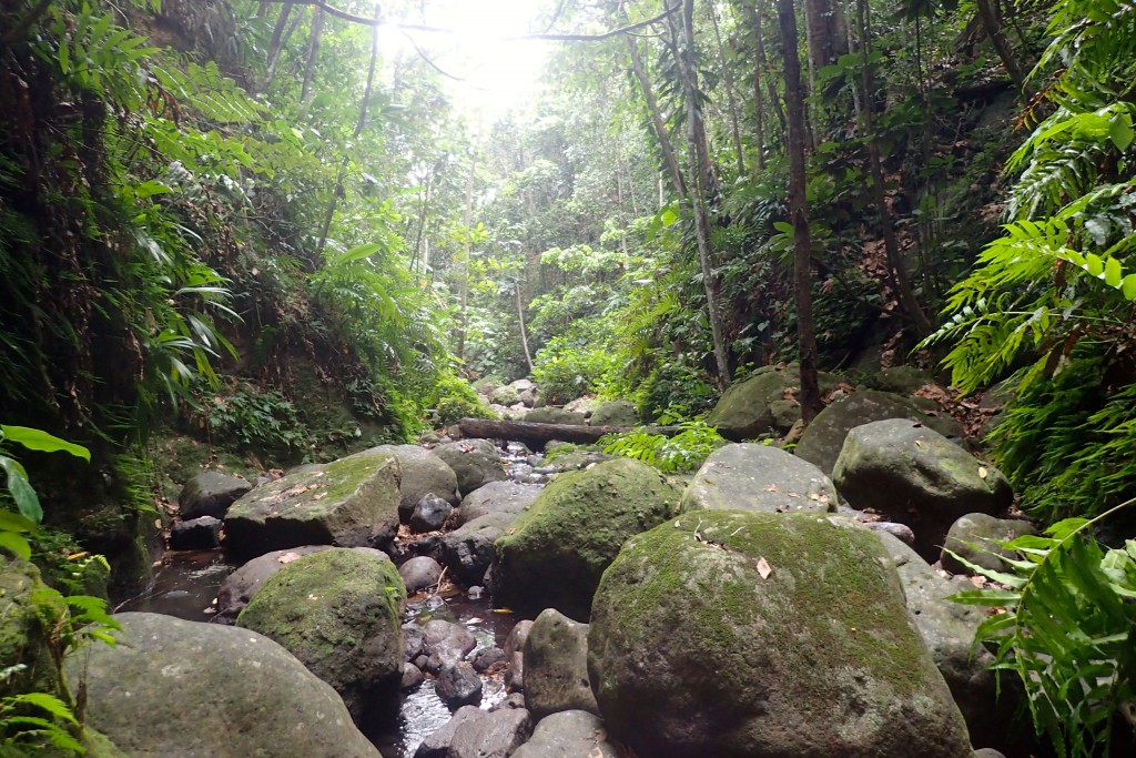
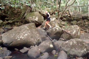
We hiked most of the river in mid May 2015, and I hiked it in late January 2016 with Henry and Catherine on Mowzer. The first time, it had rained right before we started hiking, and the rocks were nearly impossible to scramble. Jason and I spent a couple of hours very carefully keeping our center of gravity as close to the slippery rocks as we could, but had to turn back as the sun was setting. The second time, it was dry and quite easy to scramble.
Approximately 2.5 hours round trip from town
-
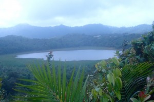
Grand Etang, Grenada Mt Qua Qua, Grenada – Mt Qua Qua overlooks the eerily calm cobalt-blue crater lake Grand Etang. From the top of the mountain, the lake looks deep enough to have dragons or dinosaurs in its depths. The guidebook says the most measured depth is 6m/20 ft; don’t believe everything you read. More water flows out of the lake than flows in, intimating a deep dark source of fresh water bubbling from below. Legend has it that Goddess Orisha tempts men down to the lake’s shores to make sacrifices, before dragging them into the depths of the lake. Beware of mermaids.
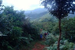 I hiked QuaQua in September 2015 with Henry and Catherine on Mowzer, Dave and Tanya on Dea Latis, Robert and Carla on Moody Mistress and Dave and Jackie on Tempo. From QuaQua we descended to Concord Falls, where I took the plunge into the pool 12m/40ft below.
Approximately 4.5 miles and 4.5 hours from Grand Etang to Concord, with a maximum elevation of 720m/2370ft.
-
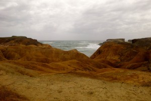
Trace des Caps Red Rocks, Martinique Trace des Caps, Martinique – Trace des Caps is a near marathon along the southeast coast of Martinique – 34 kilometers through long palm-tree-lined white-sand beaches, barren moonscape flatlands, arid red-rock cliffs, lush agricultural fields and bays with a raging sea breaking on the reef. As each kilometer is logged, you think you can’t possibly go any further, and then an entirely new landscape appears before you and you are reenergized to keep going to see what comes next. It encapsulates the plentiful variety of the Caribbean islands in one single hike. There is precious little elevation change and a few ditch-out points along the way, making this trail accessible to otherwise non-hikers.

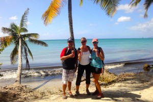
We hiked Trace des Caps twice in late December 2015, once with Henry and Catherine on Mowzer, and once with Henry and Catherine on Mowzer, Lann and Stan on Barefootlife and a couple of other boats. Both times we ditched out near the Baie des Anglais, first doing 22 kilometers and the second time 17. Lorraine stops were few and far between – be sure to pack a cooler.
-
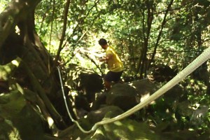
Descending into the Crater at Quill, Statia Quill, St Eustatius (601m/1972ft) – Statia is a small island, and the Quill is a small stratovolcano, relatively speaking. The hike deserves mention not because of the hike to the summit or the view from the top, but because of the descent into the crater. Even the name (Kuill in Dutch means pit) acknowledges that the volcano is special for its inside not its outside. Now dormant for thousands of years, the Quill offers hikers a chance to descend into the thick rainforest now filling the crater – hand over hand, rappelling down the large boulders. In the heart of the volcano, you can go on a peaceful, shaded stroll through the rainforest, with barely a reminder of its tumultuous erupting past. Wildlife wanders with you – from deer to goats to huge iguanas.
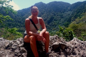
We hiked the Quill in early May 2015. Jason descended into the crater while I waited at the summit. The St. Eustatius National Parks Foundation charges a fee of US$6 per person and takes impeccable care of the trails. Approximately 2.0 hours round trip to the summit from town, another hour to the crater bottom, and another hour to walk the ledge for better views.

Fantastic hike descriptions and pics! When you come to Texas, you’ll kick butt and take names!